
Hike to the John Egan & Co. Depot Farm
Sept. 3, 2025
Backgound
John Egan (1811-1857) was an Ottawa Valley business man, railroad builder, and later a member of the legislative assembly in Quebec. He was also a key figure in the early logging that took place in current Algonquin Park.

In 1838 he founded the John Egan & Company and held the logging rights to a large area south and west of the Bonnechere River. Historian, and today a holder of an applied research archaeological license, Rory MacKay notes that “One of the earliest areas logged in current Algonquin Park was the headwaters of the Bonnechere River, at one time called the Little Bonnechere.” (note 1) In the 1840s, Egan’s company built numerous dams and log slides along the river.
In those early days of the logging industry providing food for the men employed in squaring and transporting logs was an essential element of the timber-making effort. Given the distances and costs involved in transporting supplies to the logging sites, where suitable terrain could be found, land was cleared within the timber limits to grow crops to supply the men and horses in the camps. These Depot Farms would have produced potatoes and other vegetables, as well as the hay needed for the horses.
Photo: John Egan Unknown author - This image is available from Bibliothèque et Archives nationales du Québec under the reference number P137,S4,D11,P4. Pulic Domain image.
In 1975-76, while doing oral history interviews with “old timers” familiar with the Bonnechere area, MacKay learned of an old farm – perhaps a depot farm – in the hills southwest of the Bonnechere within what is today Algonquin Park.
One of the men interviewed was John Joe Turner. He was the operator of Turner’s Camp, a site along the Bonnechere River 10 km from the entrance to the Park. As a boy working along the Bonnechere in 1910, he recalled walking a road that led from the river to a place where stones were all piled up around the trees. He was later told this was the site of a very old farm.

Algonquin Provincial Park Archives & Collections, 1976.60.122, Roderick MacKay.
John Joe Turner at Bridgedam, Bonnechere River. Used with permission
I have a vivid memory of John Joe. It was in June of 1974 during the federal election. Word had spread around Round Lake that the leader of the federal Conservatives, Robert Stanfield, would be making a brief stopover at the Bonnechere airfield. A small crowd gathered for the event, and as Mr. Stanfield stepped off the plane John Joe Turner had the task of introducing him. I can see him yet, dressed in formal black suit, top hat and tails, he called out in a loud voice: “Ladies and gentlemen, the next Prime Minister of the Dominion of Canada, the Right Honourable Robert Stanfield.” Stanfield gave a brief speech and shook hands with some of the locals, and then the plane was off. In that election Stanfield did well in eastern Canada and in parts of the West, but he was defeated by Pierre Elliot Trudeau.
Those oral interviews led MacKay to undertake a search for the farm site, and in 1979, after many explorations and with later archaeological work, all undertaken with park permissions, the grown over depot farm of John Egan & Company was located. It was situated east of Vireo Lake and about 800 meters northwest of the top of Little Hogan Lake.

The location of the farm in relation to the Basin Depot Rd. access point, the McGuey stopping place, and Bridgedam on the Bonnechere River. Map courtesy of Maps by Jeff.
Between 2001 and 2005, MacKay conducted annual field work trips to the site. Over those years, as several rectangular foundations of mounded earth, and various agricultural artifacts were uncovered, a more complete picture of the depot farm emerged. More about that later in the report.
Our Goal
For several years my brother and I had talked about trying to hike to the John Egan Company Depot Farm. While the original road, dating from the mid-1800s, from the Bonnechere River to the farm has been long lost to history, our goal was to follow a similar route. Maps from the 1940s and 1950s do show a trail that went from Bridgedam to the Clancy Fire Tower and down to Wilkins Lake, but there is no record of a road going in the direction of Little Hogan Lake and the depot farm.
In more recent decades logging operations had taken place in the area between the river and Little Hogan. A topographical map from around 1975 shows some of the roads and trails that existed at that time, and we hoped we might be able to find some indication of those trails, if they were still visible, in order to make our way to the farm site.

Older topographical map showing logging roads or trails in the area we hoped to travel.
The Hike
We got an early start on the morning of Sept. 3, and arrived at the trail into the McGuey Farm on the Bonnechere River just before 7:00 AM. The trail is one of several hiking trails promoted by the Friends of the Bonnechere River Provincial Park. Dennis McGuey and his wife Margaret established a homestead along the river in the 1870s and raised a family of 9. Their farm house included a large room which served as a stopping place for men travelling to work sites in the area. At that time a road ran from their farm up to White Partridge Lake. (note 2)

Start of the trail to the McGuey homestead.

The Bonnechere River just above the McGuey homestead

Travelling upriver toward Bridgedam. There is a trail a short distance in from the river bank, but even this trail seems rarely used now and is getting grown over.

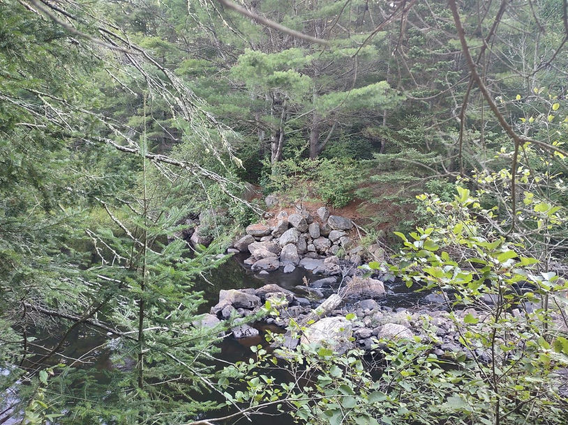
Bridgedam - the site has changed considerably since the picture was taken of John Joe Turner on the bridge at this location in the 1970s. The bridge is gone but the remains of the timber crib dam are still visible under the water.

The river widens above the dam. When closed off the dam would have created a large reservoir of water which would be used to float logs downstream in the spring.

It had been an unusually dry summer so the river was low. We looked for a shallower area to make the crossing.
Now on the other side of the river looking back. The picture gives the impression that you would be able to cross on the rocks but that is not the case. The water was up to mid-thigh level where we crossed, and with it being a narrow spot in the river the current is quite strong.

After a quick look around it was apparent that there was no longer a road or trail to follow. Even if we did find signs of the old trails we would have a lot of bushwhacking ahead of us. We had a look at our maps at this point and set some target points before setting off.

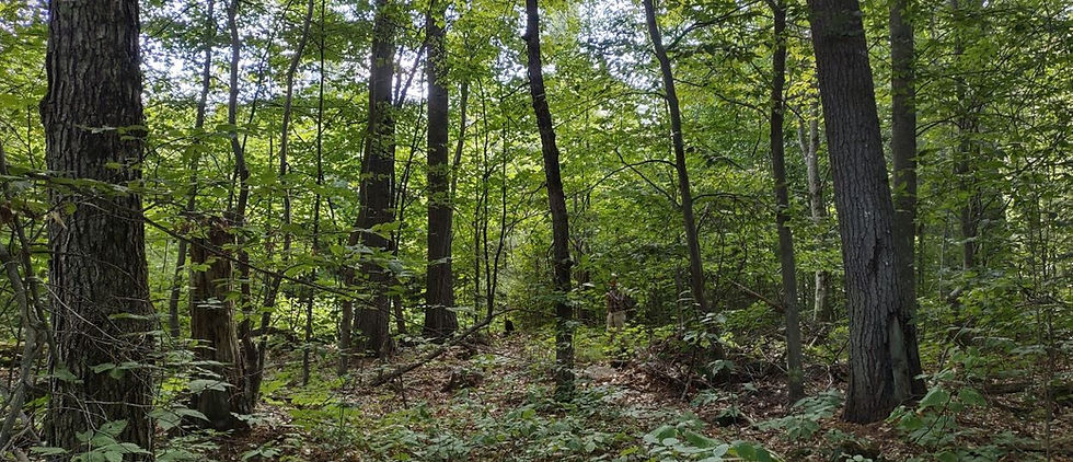
This is a sample of what a lot of the route is like.

The first wet area to get around.

In some areas we knew we were on the old logging trail by the relatively new growth of pine and balsam, and by looking ahead some distance you can see an opening between the older trees where the road would have run.

This was an interesting spot. Beavers had built a dam along the edge of this pond and below the log in the foreground were large level rocks and old timbers which suggests a bridge of some type had once stood here.

This was the clearest sign of the old trail that we came across, but even here it meant crawling under the trees. In the first hours of the hike we were averaging only 1.5 to 1.7 km / hr. It was going to be a long day.

This was part of a long climb toward the higher elevation on which the Egan Depot Farm was located. The app we were using indicated the elevation at our starting point was 244m, and after a gradual incline we made a steep climb to about 400m at this point, ultimately reaching 429m (see graphic at the end of the report).

After 4 hours of walking, as we were getting closer to Little Hogan Lake, we came across the remains of another older logging or skidder trail, but it started taking us toward the south end of the lake so we left it and resumed bushwhacking. Around 11:30 AM we were above the north end of the lake and came to a small opening in the bush. The app we were using indicated we were about 650m from the farm's GPS coordinates, and should have been very near the road or trail that Rory MacKay would have used to travel into the site. After some searching we did find a cut into the hillside indicating there once was a road here.

Arriving at the site of the farm we discovered, not surprisingly that it is completely grown over. We did have with us a copy of the sketch of the site included in Rory's article Potatoes in the Pines: Depot Farms in Algonquin Park, and we used it to see if we might be able to identify any of the features outlined in the drawing.

We did come across a distinctive depression in one spot and numerous stones piles, but were unable to determine if they were some of the items noted in the sketch. The stone piles were one of the features that first enabled identification of the site as the Depot Farm of John Egan & Co. What follows are several pictures of the site. I wish I had something more identifiable but this presents an accurate sense of how it looks today.
In walking to the site we did wonder why they would have established the farm so far from the Bonnechere River, and so high in the hills. But as we made our way from the river to these higher elevations the shift from pine bush to hardwood forest was distinct, so it may have been that these hardwood grounds produced richer soil and better growing conditions for the crops. A note from MacKay on this point added that it has been suggested that many old farms were located on elevated north east slopes, perhaps because the microclimate was best there for the growth of crops, and the colder air in lake and stream valleys could be avoided.


Algonquin Provincial Park Archives & Collections, APM 4967.
Rory MacKay at the John Egan Depot Farm, October 1979. Used with permission.
In corresponding with Mr. MacKay after the hike he informed me that he and his colleague, Ron Pittaway, knew they were in the farm when they found their first stone pile or clearance cairn. Another clue that this had once been a cleared area was the presence of old pines with large basal limbs, indicating growth in the open, and not in forest. In 1861 the farm had been 150 acres of cleared land. In the first edition of Spirits of the Little Bonnechere, published in 1996, Mackay had written that the early field work indicated there were at least 35 stone piles. Disappointingly, the hardwood forest on the site was harvested in 2000 and 2001 which altered the site considerably. However, in later field work, after 2001 and with help from the Algonquin Forestry Authority, over 600 stone piles were counted amongst the logging debris. Research undertaken between 2001 and 2005 enabled MacKay to determine that the farm was abandoned in 1867.

At one point during our explorations my brother called out saying he thought he had discovered an artifact. (I should note here that we were aware in going to the site that if we did find any artifacts they were not to be collected or moved.) I walked toward him hoping he might have identified some type of farming instrument on the ground; only to discover he was joking. What he had found was a deflated helium birthday balloon with the image of Snow White printed on it. It likely drifted in from some distant location -- a modern day artifact. This is the 11th such balloon we have found during our hikes in recent years. We seem to have a knack for finding these things and hauling them out of the park.
At 12:30 PM we had been travelling for 5.5 hrs. and decided we would have to start our return journey. The hike in had been so time consuming that we decided we would return by a different route. It would mean travelling a long distance away from our starting point before circling back, but the walking would be easier. Back in 2020 we had hiked to Little Hogan Lake. Our route that time was not cross country from the Bonnechere River. On that occasion we hiked in from the hydro line down a trail we knew as the Vireo Lake Trail.
So, after leaving the farm site we planned to make our way further south above Little Hogan where we could hit that Vireo Lake Trail and then go northwest to the Hydro Line corridor. Once on the hydro line we would at least be walking on a road and not have to deal with more bushwhacking.

On this image, courtesy of FishOnLine, I have traced our route over to the Vireo Lake trail. This involved winding our way above the lake for approx 1.25 km. Here, too, it was slow going and several times the trail simply ended in a wall of white pine. After getting to the intersection and onto the Vireo Lake Trail we made better time. But even here we were surprised to see how grown over the trail has become since we were on it in 2020. Back then two people could walk side by side; now it is down to a single path on which vines and branches tug at your feet on almost every step. It appears to have been many years since any windfall has been removed from the trail. Once on the trail we had more than 5 km to travel to reach the hydro line.
In one spot we passed a beautiful stand of huge Eastern Hemlock; a species that is becoming increasingly rare and threatened in Ontario.
Important Note: This aerial photo was taken around 2015 and the signs of logging are clearly evident. However, most of the trails and logging roads that appear in this image are now grown over. It would be very easy to lose one's way in this area which is now much more densely forested than it appears in the photo.

We made it to the hydro line and now were headed back in the direction of our starting point.

We would travel along the road as far as it is visible in this picture to reach the Basin Depot Rd.

Km 33 on the Basin Depot Rd. We needed to get down to the 25 km mark where the McGuey Farm trail starts, and where the truck was parked.

Bastise Creek

The campsite on Buck Lake at km 31 on the Basin Depot Road.

We were feeling pretty tired at this point, and with our water supply running low thirsty as well; so my brother decided to take a quick swim to cool off before we set off to complete the final section of the hike. Out of water, we arrived at our starting point at 5:38 PM, 10 hours and 46 minutes after setting off to find the depot farm. We had kept some water in the truck knowing we would need it after finishing the hike -- I don't think I ever appreciated a drink of water more.
This was a challenging hike, but well worth the effort. After reading the history and archaeology of this area of the park as recorded by Rory MacKay, and now having seen the site ourselves, we can very much appreciate and support the recommendation he made some years ago that the farm be included as a historic zone in any future revision of the Algonquin Park Historic Zone system, within the Algonquin Park Management Plan.
______________________________________-----

Our route: 32.28 km 10 hrs 46 min


Acknowledgements
We want to thank Rory MacKay for his assistance and for granting photo permissions; Jeffrey McMurtrie for providing mapping information and encouragement; and Emily Welsh, Collections Coordinator, Friends of Algonquin Park, for her enthusiastic assistance.
Sources
Note 1 -- Roderick MacKay, Potatoes in the Pines: Depot Farms in Algonquin Park; with particular investigations at the Egan Farm, BkGl-1, Clancy Township, Bonnechere Cultural Heritage Project / Ottawa Chapter O.A.S.
Note 2 -- Mark Stabb and Roderick Mackay (2002), Walks of the Little Bonnechere River, The Friends of Bonnechere Parks.
and Roderick MacKay (1996), Spirits of the Little Bonnechere: A History of Exploration, Logging and Settlement 1800to 1920, Friends of Bonnechere Parks.