
Hike to East Alder
May 13, 2025
Those who have travelled the route from Linda Lake to Burnt Island Lake will be familiar with Alder Lake; a small lake a short distance south of Burnt Island. Less well known is East Alder Lake on the other side of the Park. That was the destination for this hike.

East Alder circled -- in the top left corner is the cart trail to Barron Lake. Map courtesy of Maps by Jeff.

There were swarms of black flies around us as soon as we stepped out of the truck. We followed an old logging road for about 3.5 km. before bushwhacking to East Alder. A recent storm had knocked down trees along the route.

Despite the flies, early spring is a nice time to be in the Park with so much vegetation coming into bloom. Here the red buds of the maple trees.
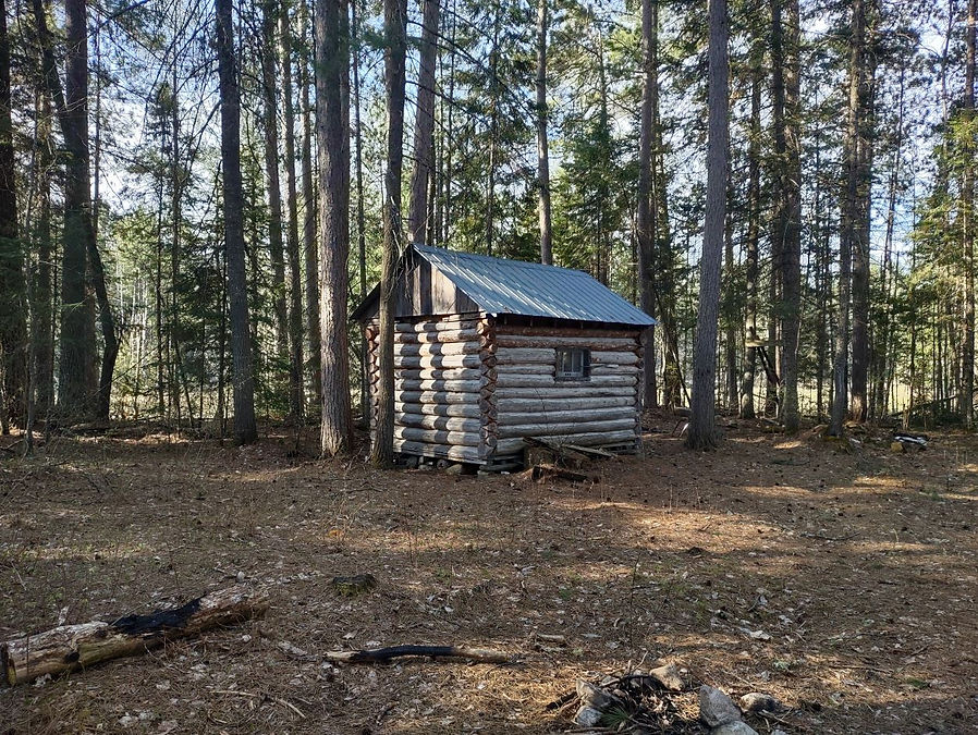
We noticed this cabin a short distance off the trail. There were deep bear scratches on the door and fresh bear scat along the trail.

We had to skirt around this beaver pond -- the first of several we would encounter on the hike. Reaching East Alder Lake is challenging due to a very large wetland west of the lake. Hiking in means bushwhacking around marshes and ponds in an effort to find some dry land while also trying to maintain a line to the destination.

This beaver pond was almost completely dried up. The open space provided a nice break from working through dense forest.

On this higher ground we came across an older skidder trail. Logging in this area must have taken place a good many years ago. The trail did not go far, ending at a pond a short distance from the top of the hill.

This picture provides a better sense of what the terrain is like. In some places we had no choice but to try and find a way across by walking on moss covered logs.

This image provides a sense of how thick the black flies and mosquitos were.
In this large area the ground was covered with the thickest moss we had ever seen. It was like walking on wet sponge.

In preparing for the trip we had examined a number of maps and knew we would have to get to this particular spot if we were going to make it to the lake. It is a narrow bridge of land separating a long, narrow series of ponds that run parallel to East Alder (see map at end of the report). Beavers had built a dam at this location. There were tracks of a young moose in the mud along the top of the dam. Tracks on either side suggested that the cow had walked through the water while the calf chose to cross on the dam.

First view of East Alder Lake. There were two loons just in front of us. They stayed close while we had our lunch -- perhaps they had a nest nearby.


Heading back -- on this hike if you are not walking through bog you are climbing over deadfall.

Fern fronds unfurling

We have been watching for Smooth Green Snakes on our recent hikes, but the only snake we saw this time was this angry looking Eastern Gartersnake.

After making our way back to the logging road we had waked in on, we decided it was early enough that we could go ahead to Feely Lake. This picture shows the southern end of the lake.

Two pictures of Feely Lake

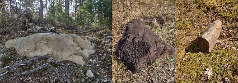
Some of the rock formations that caught our attention. From a distance the one on the right looked like a mailbox.

A painted turtle basking in the sun.
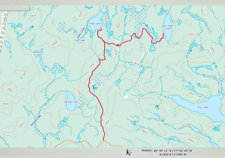
Our route -- distance travelled 17 km.

This provides a better picture of the wetland, marshes and ponds that need to be avoided in making your way to East Alder.